r o m a n i a
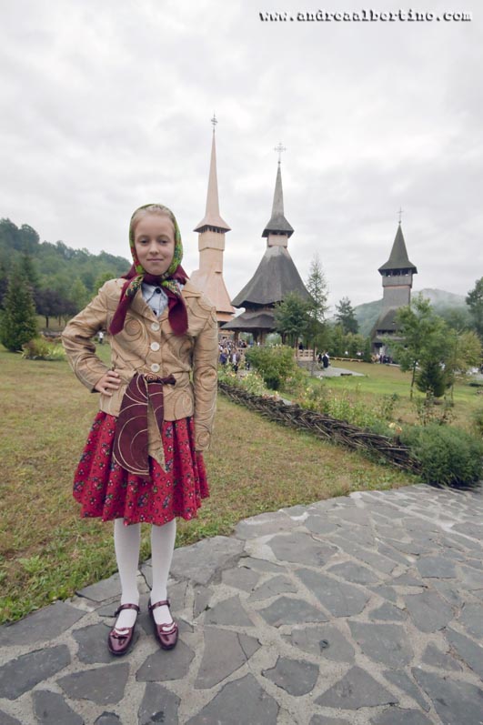
 Girl dressed in popular costume, Voronet
 Vatra Moldovitei
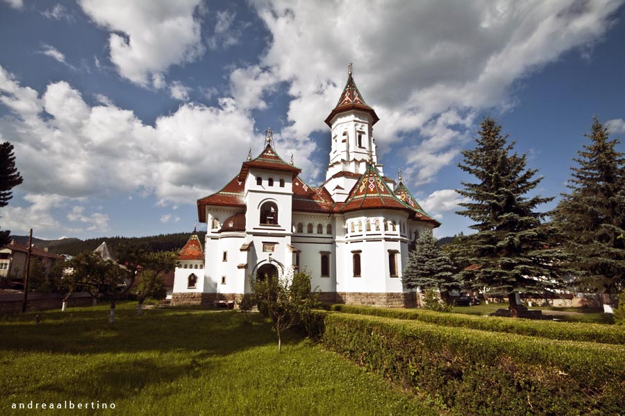
 Sucevita-Moldovita
 Sucevita-Moldovita
 Bucharest, Cismigiu Park
 Campolung Moldovenesc
 Campolung Moldovenesc
 Voronet
 Voronet
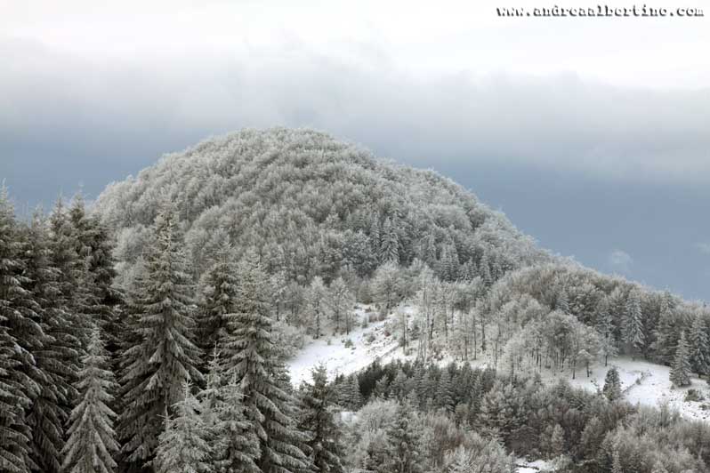
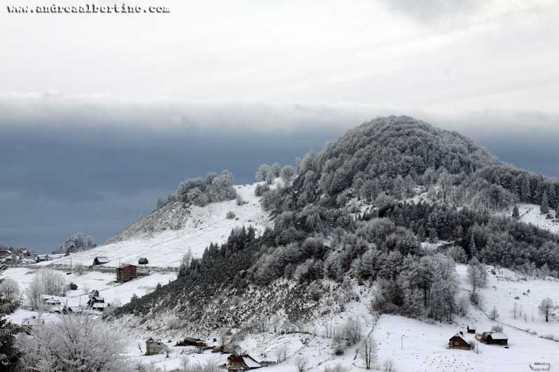
 Bucovina
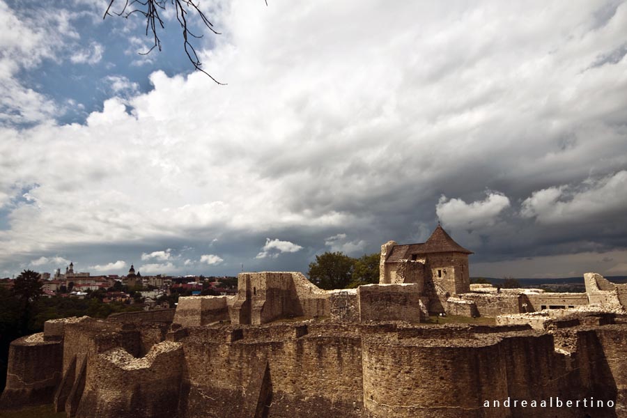 Suceava
 View from Brann
 Sibiu
Sibiu
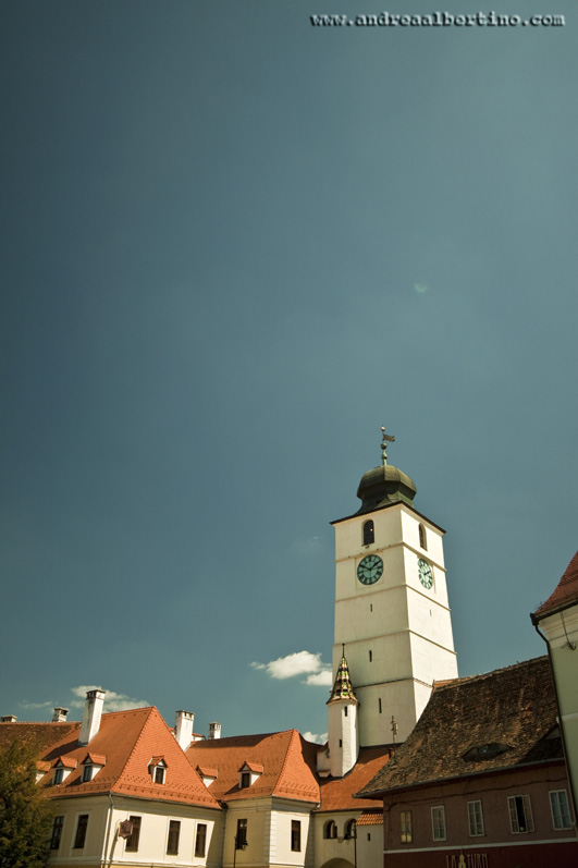 Sibiu
Sibiu
 Sibiu
Sibiu
 Sibiu
Sibiu
 Maramures - Firiza
 Maramures - Izvoarele
 Maramures - Izvoarele
 Maramures - Poienile Izei
 Maramures - Ieud
 Maramures - Firiza
 Maramures - Sapanta
 Maramures - Plopis
 Maramures - Plopis
 Maramures - Plopis
 Maramures - Barsana
 Maramures - Barsana
 Maramures - Barsana
 Maramures - Barsana
 Bucharest
 Bucharest - Herastrau Lake
 Sinaia - Peles Castle
 Sinaia
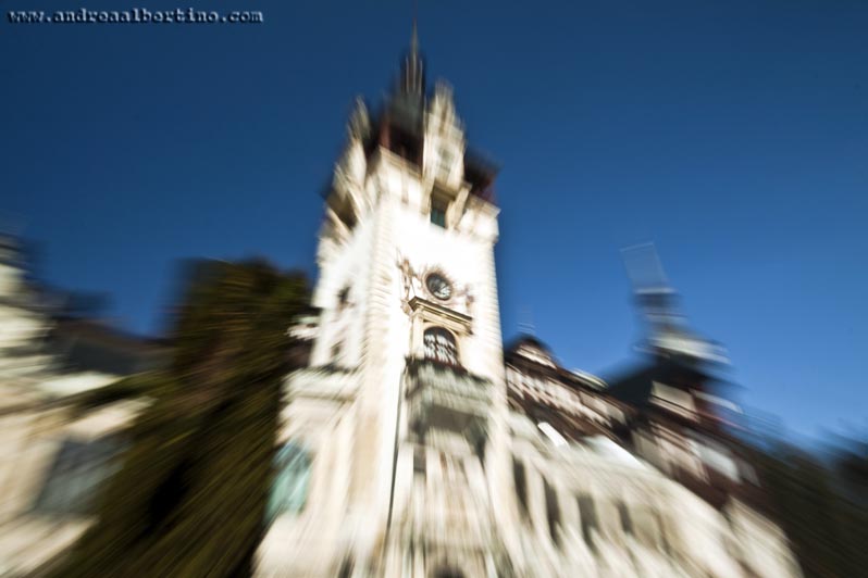
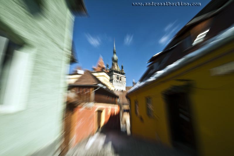 Sighisoara
 Sighisoara
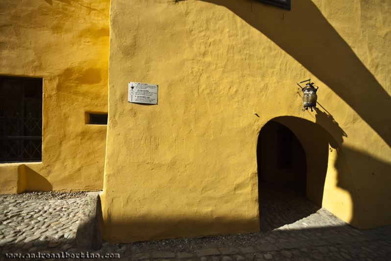 Sighisoara - Dracula's house
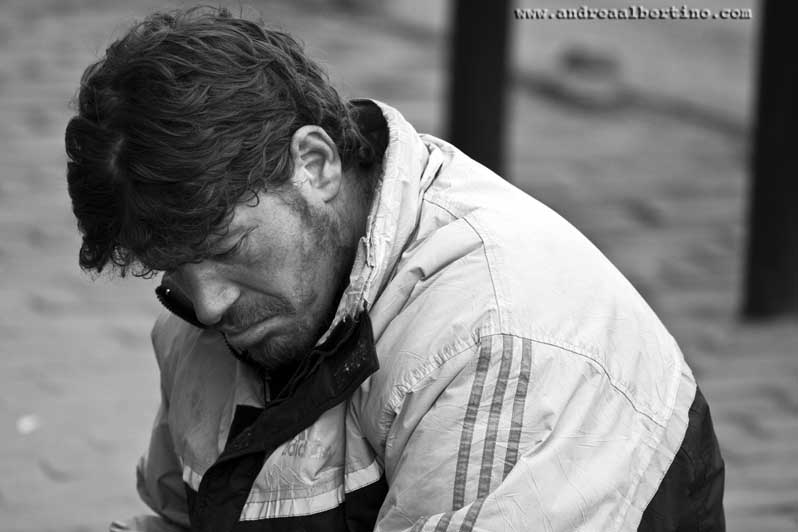 Portrait
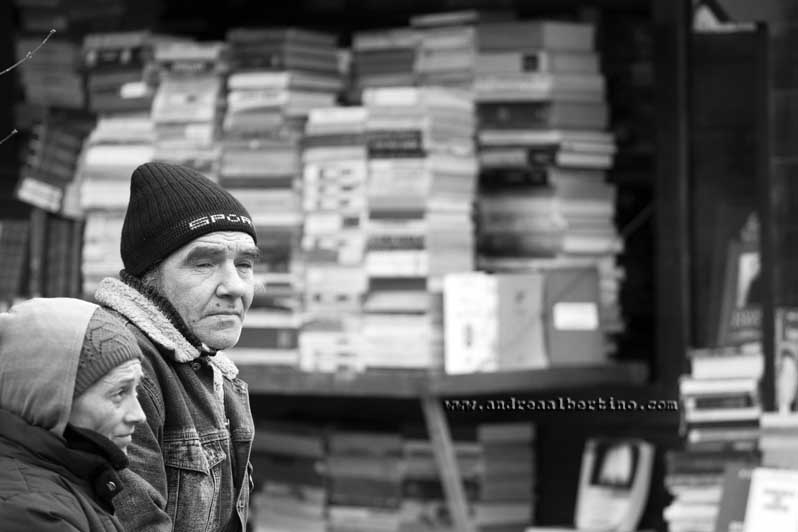 Portrait
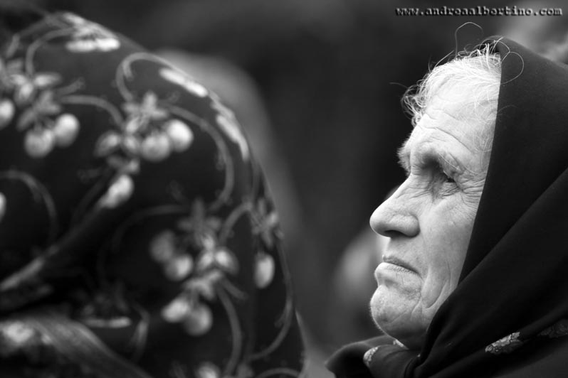
 Old woman in Brann
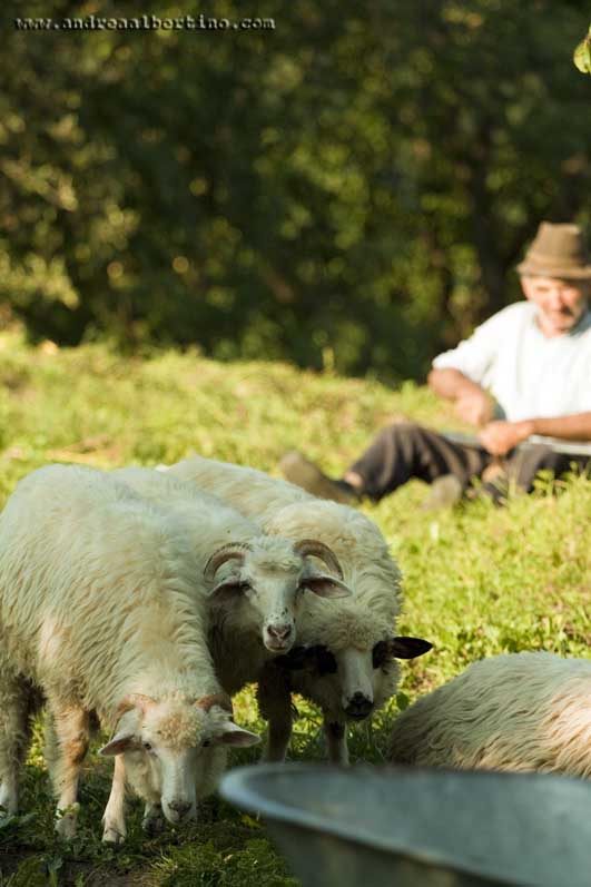
 Moeciu de Sus
 Moeciu de Sus
 Moeciu de Sus
 Moeciu de Sus
 Moeciu de Sus
 Moeciu de Sus
 Moeciu de Sus
 Bucharest
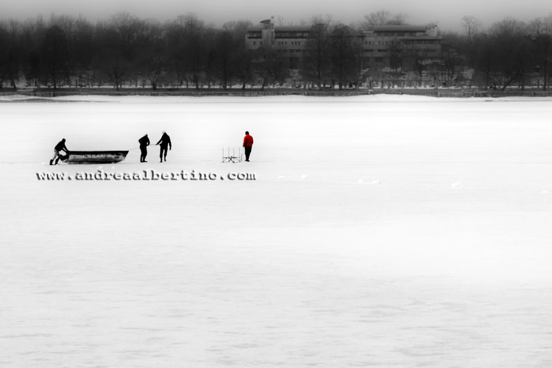
 Snagov lake
 Parcul Herastrau - Bucharest
 Parcul Herastrau - Bucharest
 Palace of Parliament - Bucharest
 Long Exposure in Bucharest
Suceava is the place of several medieval sites that are closely linked with the history of Principality of Moldavia. The most significant and the best preserved in time is the Seat Fortress of Suceava (Cetatea de Scaun a Sucevei) or Suceava Citadel, a medieval castle situated on the eastern edge of the contemporary city. The fortress was built during the reign of Petru II of Moldavia (1375-1391), also known as Petru Mușat, and then expanded and strengthened during the reign of Alexander I of Moldavia (1400-1432) and Stephen the Great (1457-1504). The medieval castle was part of the fortification system built in Moldavia in the late 14th century, because of the emergence of the Ottoman danger. It became strong enough to hold off an attack by Ottoman sultan Mehmed II (the conqueror of Constantinople), in 1476. Suceava was the capital city of the former Principality of Moldavia between 1388 and 1565. During this period, the castle served as princely residence. Alexandru Lăpușneanu moved the capital to Iași in 1565, so the castle lost its status. After this moment, the citadel entered a period of decline. In 1675, during the reign of voivode Dumitrașcu Cantacuzino, the fortress was destroyed. Then, for over two centuries the castle was deserted. In late 19th century and early 20th century, under the patronage of Austrian architect Karl Adolf Romstorfer, it took place rehabilitation works and archaeological researches. Between 1961 and 1970 other restoration and consolidation works were carried out. In 2013 a major reconstruction program was launched, to return the castle to its original architecture and shape. The Seat Fortress of Suceava consists of two concentric citadels. The inner citadel, known as fortul mușatin, has a rectangular shape and a patio. It was built by Petru Mușat in late 14th century. In the second half of the 15th century, Stephen the Great expanded the structure, by adding another citadel that has a circular shape and surrounds the old one. After 1476, new fortifications were added to the outer citadel. The whole castle is encircled by a large defensive ditch. Today, the fortress is a landmark of Suceava and a touristic attraction.
Bukovina (Romanian: Bucovina; Ukrainian: Буковина Bukovyna; Hungarian: Bukovina; German and Polish: Bukowina; see also other languages) is a historical region in Central Europe, divided between Romania and Ukraine, located on the northern slopes of the central Eastern Carpathians and the adjoining plains. Historically part of Moldavia, the territory of what became known as Bukovina was, from 1774 to 1918, an administrative division of the Habsburg Monarchy, the Austrian Empire, and Austria-Hungary. After World War I, Romania established control over Bukovina. In 1940, the northern half of Bukovina was annexed by the Soviet Union, and nowadays is part of Ukraine.
Southern Bucovina’s historic monasteries are among the most distinctive in all Christendom. Unusually, some have frescoes both outside and inside. While the region's prevailing winds and rains mean that north-facing exterior walls have largely lost their five-century-old paintings, frescoes facing other directions have survived – almost a miracle, considering that the plaster is only 5mm thick on some of the most impressive paintings. There's no single explanation for this, though different reasons have been offered. Bucovina's clear and cold winters may have helped; historically speaking, long periods of disuse due to the Habsburgs' closures of many monasteries (after 1785) and Communist neglect may also have helped preserve the frescoes. Unfortunately, more senseless damage has also occurred – you'll note visitors' names (from both Austro-Hungarian and modern times) chiselled into paintings, along with the date; there's something deeply unsettling about seeing graffiti scrawled over a century ago, appearing to have been inscribed just yesterday. While wall paintings and icons are common in Orthodox churches, external frescoes are more rare. Different explanations have been given for this too. Since these fortified monasteries were created when the Turks threatened, large numbers of soldiers would have been garrisoned within; they, like the villagers, were largely illiterate. Further, during services, these small churches could hold few parishioners (generally, the nobility). The edifying outdoor paintings thus helped explain biblical stories and ethical concepts to the masses – useful too, considering that liturgies in Old Church Slavonic were unintelligible to most Romanians. Majestic sacred art was also a potent symbol of Orthodoxy later, when the Habsburgs sought to Catholicise their subjects. A guided tour is the most time-efficient and informative way to visit. Alternatively, renting a car allows you flexibility. Otherwise, public transport is possible, but difficult, requiring hopping around and backtracking. Hitching is not as safe as it was and isn't recommended. All monasteries operate from 8am to 7pm in summer, to 4pm in winter. In addition to accommodation options listed below, Suceava tour operators can book rural pensiunes; also see www.ruraltourism.ro or www.antrec.ro. Note that most monasteries charge an entrance fee (5 lei for adults, 2 lei for students and children) and 10 or even 15 lei for photos and video; both are allowed on monastic grounds, but not inside the churches. Smoking is forbidden, and visitors should dress 'respectfully'; wearing shorts and hats (for men) is forbidden, and women are required to cover their shoulders and wear trousers or long skirts. If you strive for even more perfect Orthodox practice, don't put your hands in your pockets inside a church and always exit while facing indoors.
The Transfagarasan mountain road or national road 7C is one of the most spectacular roads in the world. It is 90 km (56 miles) long and is located in Romania. It runs trough the Fagaras mountains (trans + Fagaras), a part of the Transsylvanian Alps. The road connects Transsylvania with Muntenia. The Transfagarasan starts at Bascov, near Pitesti. It follows the valley of the river Argea and after mounting to the highest point, it descends to Cartisoara in the Olt valley, where the road ends. The Transfagarasan rises to a height of 2134 meter and has sharp hairpin turns, a challenge for every driver. The maximum speed is 40km/h (25 miles/h). The road is often closed from October till June due to the snow that is blocking the road. Sometimes the road can be open as late as November, but on the other hand it has been known to snow as late as August so it's always good to check ahead of time on the weather and road conditions. The road has more tunnels and viaducts then any other road in Romania. On the highest point of the Transfagarasan near Balea Lac (Balea-lake) is located the longest (ca. 875 m/0.53miles), and highest tunnel of Romania. This tunnel is the connection between Transsylvania and Walachia. In September 2009 the British television show Top Gear was filming along the road. Host Jeremy Clarkson claimed the Transfagarasan as the best road in the world. The road has more tunnels and viaducts then any other road in Romania. On the highest point of the Transfagarasan near Balea Lac (Balea-lake) is located the longest (ca. 875 m/0.53miles), and highest tunnel of Romania. This tunnel is the connection between Transsylvania and Walachia. In September 2009 the British television show Top Gear was filming along the road. Host Jeremy Clarkson claimed the Transfagarasan as the best road in the world. History: The Transfagarasan was built between 1970 and 1974 by military forces. After the 1968 invasion of Czechoslovakia by the Soviets, Nicolae Ceausescu had it built as a strategic military route to cross the mountains in the event the Soviets attempted a similar move into Romania. The builders used 6000 tons of dynamite to clear a path for the road on the northern side of the mountains (this is the most spectacular) and on the tunnel. 40 soldiers lost their lives during construction. Transfagarasan Road Trip: A few miles beyond Curtea de Arges the Transfagarasan road starts to face the mountain slope. You can see a typical mountain landscape with pines and alpine meadows. The road is not in good shape here, so pay attention for holes and stones. The Transfagarasan runs trough the Arges River gorge. After travelling beyond the last village, Capataneni, you'll see a road sign to Poenari Castle. This castle was property of Vlad III the Impaler. Vlad earned his nickname by impaling, torturing, burning, skinning, roasting, and boiling people who did things that displeased Vlad; stealing, lying, and adulterous relations. In this way Vlad kept his people in order and taught them that stealing would not be tolerated in his lands. Bram stoker's Dracula was based on his personality. When you look up on the mountains you can see his fortress on the top of a high and remote cliff. It will take 1480 stairs before you reach the top, but the view is certainly worth the effort. If you follow the road further north, you'll reach Vidraru Lake. This lake is a man-made reservoir retained by a dam. The dam is 165 meters high, 305 meters long and holds 465 million cubic meters of water. When the dam was completed, it ranked 5th in Europe and 9th in the world. In an average hydrological year it can generate approximately of 400 GWh/year. The road runs over this dam. At this point the road splits up. One follows the left side of the lake, the other the right side. You should take the right one, it's in far better condition then the left one and it's 3km/2miles longer. Both roads meet at the northern side of the lake. As you continue you will see a waterfall and some great scenic spots. Eventually, when you're near the top of the road you will see the tunnel under the Paltinu Ridge. Be careful inside the tunnel. Regardless of weather conditions outside, the road in the tunnel is always wet and can be slippery. When you leave the tunnel you are at the highest point of the Transfagarasan, Balea Lake. There is a parking just after the tunnel. Balea Lake is a glacier lake with clear, icy water. It's surrounded by mountain peaks. The first European ice hotel was built here in 2006. Since then it's constructed here every year in December with ice from the frozen lake. Since the road is closed during winter, it can only be reached by cable car from Balea Falls. Usually the hotel remains open until it melts in April. When you go down on the northern side of the road, you can see the sharp descent and the hairpin turns. In good weather the road is almost entirely visible. Along the way to Balea Cascada (Falls) you can see the cable cars gliding up and down the mountain. In winter, when the road is blocked by snow, this is the highest point you can reach by car. There are some great viewing points here. While descending, views of rocks, jagged edges and meadows are replaced with dense pine forests. Eventually you'll end up in Cartisoara, where you can visit the Cistercian monastery. The road ends a few miles further North. If you are on vacation in Romania between June and September, the Transfagarasan road is an amazing and unforgettable driving experience for drivers and bikers.
Info